Lietuviškai
 Latviešu
 English
 Русский

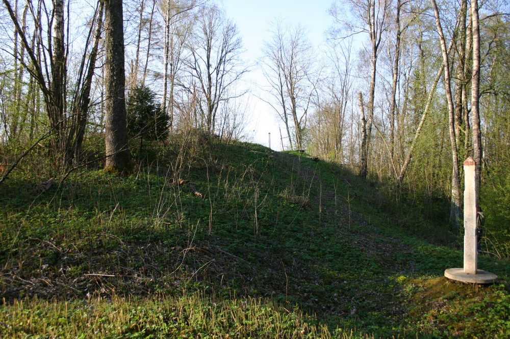
The mound is located on the top of the dominant hill in the area, on the border with Latvia. The site is oval, size 26×13 m. On the north-western slope, 2 m below the site, there is a 2 m wide terrace. The slopes are steep, up to 35 m high, artificially built in the upper part of 2 m high.
It is also called Kartuvių Hill. In Latvia he is known as Petruki or Petriki.
There is a border sign no. 1251. Lithuania owns only 6 m of sites in the northeastern region and the southern and eastern slopes of the mound. A stone ax was found at the foot of the Latvian side in 1937. The mound is overgrown with forest with a cut-off wall strip.
The mound dates back to the end of the 1st millennium BC – the beginning of the 1st millennium.
Loading…
Address & Contact
Our Address
Juodupės sen., Rokiškio r.
GPS
56.144687966306, 25.505060248395