Lietuviškai
 Latviešu
 English
 Русский

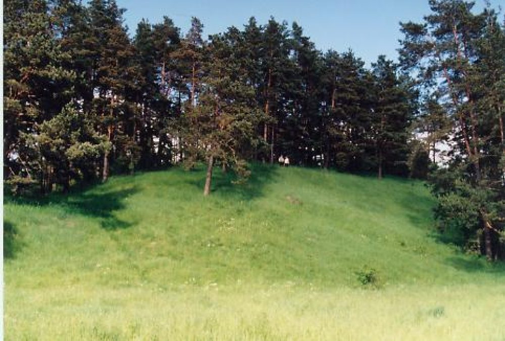
The mound (Pečianykas) is located on a hill, on the edge of a swampy valley. The site is square, elongated, up to 2 m higher on the southeast side. An embankment 0.5 m high and 6 m wide was poured on the northern edge of the site. The slopes are steep, from 4.5 m to the east to 14 m high on the south side.
In the eastern part of the site are the World War I graves. The center of the site is soiled, the edges and slopes are overgrown with rare pines.
On the eastern and southern slopes, in the area of 0.5 ha, there are IV-XIII c. foothills (studied 1958 1959, 1989 and 2002). Up to 2.8 m thick, many different finds have been found in its cultural layer: stone sharpeners and spindles, horned sumac ax and ax, bone yolks, knitters, needles, combs, brass bracelets, horseshoe brooches, neck trimmings from braids and quotes, collars, bells , iron pins, reeds, knives, needles, spears, coulter, splitter, hoe, ax, clay weights, spindles, necklaces, rough and smooth pottery, animal bones, etc.
The mound dates back to the end of the 1st millennium BC – the beginning of the 2nd millennium.
Loading…
Address & Contact
Our Address
Kamajų sen., Rokiškio r.
GPS
55.741018561974, 25.440575237299